Charts and Publications
Charts and nautical publications are essential tools for every OOW. They provide the information needed to plan, execute, and monitor a safe voyage. While modern vessels are equipped with electronic systems such as ECDIS (Electronic Chart Display and Information System), the principles of paper charts and traditional publications remain vital. Understanding these resources ensures that a navigator can always access accurate, reliable information, even if electronic systems fail. You will learn how to use both whilst at college, and during all your sea-phases.
This page introduces the key types of charts and publications used at sea and explains their importance in navigation.
Nautical Charts
A nautical chart is designed for marine navigation. Unlike road maps, charts focus on the sea and coastal features relevant to vessels. They include:
-
Depths (measured at chart datum, usually Lowest Astronomical Tide).
-
Coastlines and coastal features.
-
Navigational hazards such as rocks, wrecks, and shallow water.
-
Aids to navigation including buoys, lights, lighthouses.
-
Shipping routes, TSS's and restricted areas.
Types of Charts
-
Small-scale charts – cover large areas, suitable for ocean passage planning.
-
Medium-scale charts – used for coastal navigation.
-
Large-scale charts – provide detailed coverage of harbours, approaches, and confined waters.
Charts must always be up to date, corrected regularly using Notices to Mariners. Out-of-date charts can be dangerous, as they may miss new hazards or changes in buoyage. All corrections done on paper charts, are done in purple pen.
Chart Symbols and References
Charts use a universal set of symbols defined in the publication NP5011 (Admiralty Chart Symbols and Abbreviations).
Navigators must be able to interpret:
-
Depth soundings and contours.
-
Nature of the seabed (important for anchoring).
-
Symbols for wrecks, rocks, and obstructions.
-
Buoyage and light characteristics.
Sailing Directions (Pilot Books)
Sailing Directions, also known as Pilot Books, provide detailed descriptions of coastlines, harbours, and approaches. They contain information not easily shown on charts, such as:
-
Harbour entry procedures.
-
Local regulations.
-
Recommended anchorages.
-
Dangers not marked on charts.
-
Tidal and current information specific to the area.
- Other information on the specific area.
Tide Tables and Tidal Stream Atlases
Tides and currents are critical to safe navigation. Publications include:
-
Tide Tables – show daily predicted times and heights of high and low water for standard ports. Secondary ports are calculated using differences from the nearest standard port. Most ships will use Admiralty Total Tide (ATT).
-
Tidal Stream Atlases – provide diagrams of tidal stream direction and rate for each hour of the tidal cycle in a given area.
List of Lights and Radio Signals
The Admiralty List of Lights and Fog Signals details every major light, buoy, and beacon worldwide, giving their exact characteristics (colour, rhythm, range).
The Admiralty List of Radio Signals (ALRS) provides essential communications information, including:
-
VHF and MF/HF frequencies.
-
Coastguard stations.
-
Vessel Traffic Services (VTS).
-
Pilotage services.
-
Maritime safety information broadcasts.
Notices to Mariners
The sea is constantly changing, with new wrecks, shifting sands, and alterations to buoyage. Admiralty Notices to Mariners (NMs) are issued weekly to keep charts and publications correct. Navigators must update their charts promptly to ensure safety.
Corrections can be made manually on paper charts or automatically on ECDIS systems.
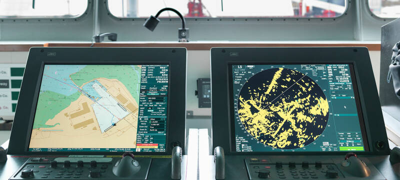
Electronic Chart Systems
While paper charts remain the legal backup, many vessels now rely on ECDIS. Electronic systems integrate GPS, AIS, radar, and chart data to provide a real-time navigational picture.
However, navigators must still understand traditional publications, since:
-
ECDIS can fail.
-
Legal carriage requirements often demand paper or backup systems.
-
Traditional publications give depth of detail not always available electronically.